Mount St. Helens National Volcanic Monument: Climbing Mount St. Helens[om_gmap zoom=”11″ lat=”46.180306″ lng=”-122.203674″ ]
Getting there:
Drive I-5 to Exit 21 / WA 503 in Woodland. Head east on 503 approximately 35 miles to USFS Road 83. Turn north on 83, go about 3 miles until USFS Road 81. Turn onto 81, travel about 2 miles and turn right onto USFS Road 830: Ptarmigan Trail and Climber’s Bivouac. Proceed to the end of the road and the trailhead.
Climber’s Parking Pass required
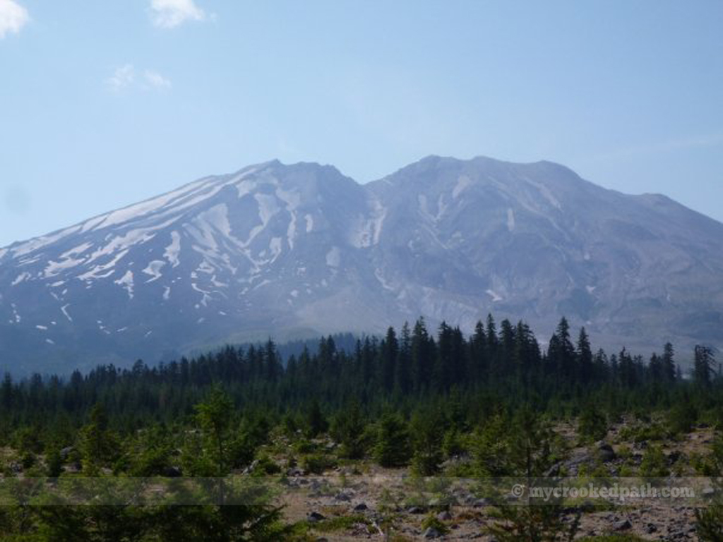
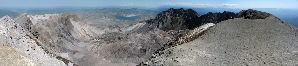
[dropcap]O[/dropcap]n 18 May 1980 at 8:32 am, Mount St. Helens erupted, causing the deadliest and most economically destructive volcanic event in the history of the United States. The eruption caused the elevation of the summit to drop from 9,677 feet to 8,365 feet and created a one mile wide horseshoe shaped crater. Still a quite active volcano, people flock to its slopes to scramble up to the crater rim. After doing some research, I found this is a relatively straightforward hike and began to make my plans.
I had planned a long weekend to make the climb. On Friday we headed out after work and drove down to make camp near the volcano. Saturday was a day of exploration and a trip through Ape Caves.
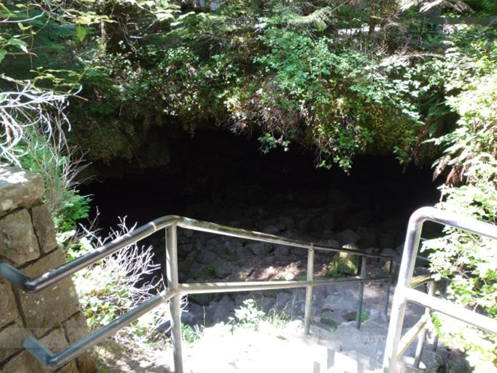
Ape Caves is the longest continuous lava tube in the continental US and was named after a group of local Boy Scouts – the St. Helens Apes. More information can be found here: Mount St. Helens National Volcanic Monument: Ape Caves
After Ape Caves, we headed down the road to the Trail of Two Forests to check out the short loop hike and find a couple of geocaches.
Next, we hopped in the Jeep to explore the east side of the blast zone. We drove FS Road 83 down toward Lava Canyon until the road was closed.
Later, we headed back past our campsite on FS Road 81 and drove until we reached a gnarly washout, blocking the loop back into Cougar.
[dropcap]T[/dropcap]he next morning came with an early start. We grabbed our gear and drove up to Climber’s Bivouac and the trail head. We hit the trail at about 0545 hours. The first two miles of the trail meanders through the forest, opening up here and there to offer views south to Mt. Hood and Mt. Adams. Once you hit the tree line (and the 4,880 ft elevation mark), the trail weaves through some boulder fields before it turns straight up the side of the mountain.
It was insanely hot that day, in the 80s. I carried my 3L camelback and another 16oz bottle of Gatorade. Ran out of both on the way back down the mountain!
[dropcap]T[/dropcap]he next day, we got up and decided to take the long way home. We headed east around the mountain, stopped at Bear Meadow where Gary Rosenquist took his über-famous eruption pictures, and then continued on up to Windy Ridge.


One comment